So Many Images, Why Settle for the First One?
Did you know that the images you see in Go iLawn and Go iPave come from literally thousands of aerial photographic sessions taken over a decade or more? It’s true, our aerial imagery for any given spot represents a virtual tapestry of images taken from different altitudes, different angles, and with different lighting and sky conditions. So if you don’t like the first image we send you, pull up another one!
Don’t Settle.
Recently, I’ve seen a few comments from users who searched on some specific address and got results with old imagery. Yes, despite our best efforts, this sometimes does happen. Hey, our imagery covers all of the USA, and the age and resolution of photos in one area can differ greatly from those in another.
Our pictures are taken from airplanes that fly a pattern to get images of an entire area. This means that images at different levels and of different angles are taken at different times.
Although we want to keep our customers supplied with the best images out there, we sometimes have to deal with limitations in what images exist. But with that said, often our users may not know that they can often find “better” images than the ones they first see on Go iLawn / Go iPave.
If you know a few tricks for using our system, you can often find images that are newer, clearer, or otherwise better than the first ones you see.
Tips and Tricks:
These methods will work within your current search, and you should be able to fully explore what’s available for a given property if you try these few tips and tricks…
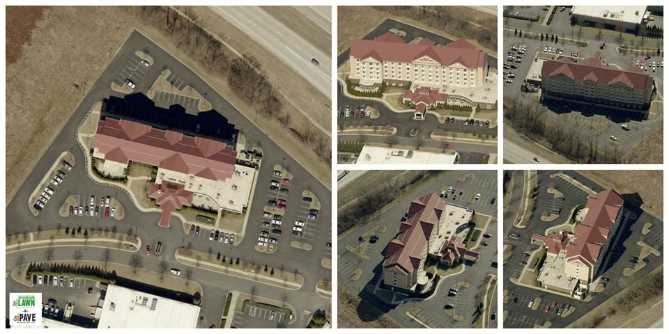
Play the Zoom game.
While your property search will usually default you to the “Property” view level, you can almost always see properties at the Med Neighborhood and High neighborhood levels too. And those images were collected completely separately from the others. In some cases, there could be a difference of 5 years or more between a property level image taken in 2009 and a Med Neighborhood level view picture taken in 2015.
Check All the Angles.
In addition to different altitudes, you’ll get images taken at different angles. And when looking at a property, you might get angle views that offer the best possible view of some or all of a location due to angles, shadows, and being taken even an hour or two apart. And in many locations, you can change back and forth between a property view and a neighborhood view while in viewing directional imagery, giving you a whole other set of images to review.
Change Levels, Then Change Back.
By changing levels, then changing back, you prompt the system to re-load its images. By re-centering on a nearby location, you could get better imagery. This works when you are at a boundary between different sets of images for example.
Check Back Later.
While we don’t update our imagery continuously, we do make new images available as soon as we get them. If you measured a property last year and it had old images, you may want to pull it up new this year to see if we’ve updated.
The Conclusion:
If you’re searching in Go iLawn or Go iPave and you land on images that aren’t perfect, take a minute or two to explore the various property view levels within Go iLawn / Go iPave. Often, you’ll find images that will work better than the originals, just by taking the time to look.
Using Directional Views:
Not sure how to do it? …check out our helpful video on how to access and utilize our Directional Imagery.


Leave a Reply
Want to join the discussion?Feel free to contribute!