The New Go iLawn / Go iPave ToolBox
The All New Go iLawn/Go iPave is a modern update on our classic software.
We combine high-resolution aerial imagery with advanced drawing and measuring tools, to help you evaluate your jobsite online. But we’re still working on finishing all the instructions and documentation for our new software.
So we’re collecting a series of Tool Tips here to help you get the most out of our software. We’ll continue to add more, so check back here for the latest.
- Tool Tip #1 – Editing Tools – Tool Tip – Access the Editing Tools
- Tool Tip #2 – Group Controls – Tool Tip – Controlling Your Groups
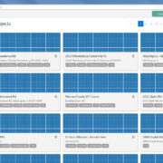
- Tool Tip #3 – My Projects – Tool Tip – My Projects
- Tool Tip #4 – Print / Save – Tool Tip – Printing and Saving Photos
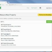
- Tool Tip #5 – Searching Properties – Tool Tip – Searching for Properties
- Tool Tip #6 – Tags & the Sidebar – Tool Tip – Tags and The Sidebar
- Tool Tip #7 – Troubleshooting – Tool Tip – Troubleshooting
What other topics would you like to see us cover?
Let us know in the Comments!

Nice! Thanks for adding the link to this support page for issues beyond the walk through!
With the new Go ipave can you turn the map clockwise or counter clockwise like you could with the old one?
Hi Bob… The “Rotate Map” feature we had in Classic Go iPave from 2015 to 2018 is not yet available in the New version. This functionality lives in a 3rd-party component we use in our software build, and we’re optimistic that they will add this function in the future. Sorry I can’t provide an ETA, but we hope to add this capability in future.
How do i turn a picture to different positions- North, South, East West.
Were are those buttons like the previous program?
Melissa, Two options… At top Right of the map, you can choose directional views. Instead of our default “Low” view, for instance, you can choose “Low West” or another choice from the drop-down. You may also access this menu by Right clicking on the map screen and choosing the 3rd option: “Select view”
hOW TO GET OFF DEFAULT
Can you elaborate?
Is the ability to mark the location you searched for with an address with GPS gone in the new go-ilawn?
For example, I search for 123 anywhere street, then i would use the gps location button to mark it. The gps coordinates then are copied out and are used fro routing crews. Where is this?
Ken, Thanks for your question… You can get the GPS coordinates of any location on your Go iLawn/Go iPave screen. We’ve combined this feature into our Count function. Each count item now includes that point’s GPS coordinates, and will be part of a group. You can have as many as you like. Here’s how:
* First, choose a group. For the way you describe using it, you may want to create a dedicated group like (Location) or (Destination), or (Routing)
* Next select the “Count” option from the toolbar (Click the # sign) and click to create a “Point” on the map.
* Then click the pointer icon (“arrow” at top of toolbar).
* Last, use the Pointer to click the point you created.
Its Latitude and Longitude coordinates appear on the second line of the “Editing Dialog Box” that opens up after you click. You can copy and paste them out (like this – 36.0061, -86.8185) to use them however you like.
Is there an ability to delete a section within a highlighted group? For example, if I am measuring a lawn area, but there is a bed in the middle, can i go back and delete the portion that is the bed? In the older version you were able to do so, but I can’t figure out how to do it in this updated version.
Thanks!
Kim. Thanks for asking… Yes you can do this, and yes, it works a little differently.
You’ll use the “Cutout Area” tool, which lets you draw an area inside the shape to remove it. Use it to remove mulch beds from your lawn size or islands from a parking lot.
Once you’ve identified an area you want to “Cutout” from, take these steps:
1. Click the “Pointer” icon at top of the toolbar
2. Click on the shape you want to edit
3. Select the Cutout Area icon in the popup box
4. Draw the Cutout(s) you want to remove from this area.
Read more about this and our other editing tools Here: https://goitalk.com/tool-tip-access-the-editing-tools/
Thank you for the reply! I figured you had a way to do it, but just haven’t been able to find it. Actually, I’m still having some trouble. I can’t seem to get a pop-up box to show? How do I get that to appear?
Thanks!
Keep your eye on the Drawing Tool Tips for instructions that might help. This is the grey box at the bottom left of your picture. It includes tips on what to do next and handy buttons to Complete, Cancel, or Stop what you’re doing. Often, if the system isn’t doing what you think it should, you may already be in an editing or drawing mode. If you click the “Stop” or “Cancel” buttons in the Drawing Tool Tips box, it will take you back to default mode. If this doesn’t help, try refreshing your browser to reset the system.
Can we check to see what the elevation points are any more?
Dennis… The elevation of points is not part of our current software.
Is it possible to change the opaqueness of the overlays like in the classic goiLawn?
David,
Thanks for your message. Yes, this is possible. In the New Go iLawn, opaqueness and color of your shapes is called “Fill”. It is controlled at the Group level.
To change it, open your project, then go to your Groups at Left. Click the “pencil” icon next to any group name to open up the editing view (Here’s a picture: https://goitalk.com/wp-content/uploads/2018/08/Groups-Controls.jpg ) … Where it says “Fill”, there will be a percentage number… click it… then click the bar that appears, to choose a lighter or darker shading.
Read all about the Groups controls here: https://goitalk.com/tool-tip-controlling-your-groups/
I want to spin the direction of the map without it being on low. Why is this not an option anymore?
Hi Joe. Thanks for commenting…. The feature we call “Map Rotation” was active in Classic Go iLawn from 2015 to 2018, but we can’t have it in New Go iLawn yet for technical reasons. On of our software components doesn’t support rotation yet, and we have to wait for the creator of that component to add it. We’re hopeful that this will become available soon, and we will add it to the New GO iLawn as soon as possible.
How do I change the color of the labels ? Currently they are only white and
Adam,
Thanks for your comment.
Label text is permanently set to the color scheme of white lettering with a black outline. This is a “universal” setup that can be seen and read on any background.
This was a design compromise based on technical challenges that made it impossible for us to create a changeable color palette for text and have it work across different zooms and views.
We may revisit this issue in the future, but it is not on our current project list.
So I take it from the thread above that we can no longer measure height. While not a majority of my measuring I did use that feature for measuring tree height to calculate Christmas lights. Can you suggest a solution? Is Classic still available for this feature?
Jeff,
You are correct that this feature is not currently available in New.
Our development team has been working to enable drawing “in the angles”, but the test versions I’ve seen did not yet include a height measurement.
The Classic is no longer available for purchase or re-activation, and I’m not aware of any other solutions that would get you this capability.
I have a property outlines and marked out how do i save a image to my documents? So that I can crop and rotate it on my computer? Thank you…
John,
Thanks for asking. For saving images, we have several recommended methods as detailed here: https://goitalk.com/tool-tip-printing-and-saving-photos/
It sounds like you need to save your photo with drawings as a .jpg, so you can edit it in some kind of photo editing software?
For this, we recommend Option #2, the Microsoft snipping tool for Windows users and Option #4, the Firefox web browser’s native screenshot toolkit for Mac users. See the link above for more details on these.