3 Tools to Help You Measure More Properties in Less Time for Landscaping and Pavement Maintenance Estimates
Believe it or not, Memorial Day has already come and gone. Soon enough it will be summer, which for landscape and paving contractors equates to long days of servicing clients, repairing equipment and putting out fires.
For our team at Go iLawn and Go iPave, summertime means we have a little lull in phone calls and support emails. Many of our customers are busy servicing the clients that they measured properties for months ago, so we don’t hear from them as much.
But when we do hear from our users there is definitely an underlying sense of urgency on the other end of the line. You can just feel that there aren’t enough hours in the day to get done what a service contractor needs to get done in the summer months!
Measure More Properties with 3 Easy Tools
So in an effort to help you get home earlier, please your customers faster, make a good impression on a prospect quicker…we want to make sure you know about these three tools in Go iLawn and Go iPave that will help you measure more turf areas, parking lots, mulch beds, roadways etc., in less time.
The Parcel-to-Parcel Tool
The parcel-to-parcel tool is a great marketing tool. It not only shows you the legal property boundaries for the property you need to measure for an estimate, but it will also reveal property boundaries and addresses for the neighboring properties that you can see in our photos. Yep, that’s right, you aren’t limited to measuring just one property when you are using Go iLawn and Go iPave. You can measure everything you can see- which sometimes includes hundreds of properties.
Residential areas or commercial corridors is where you can get the most traction with this tool. It looks like a four leaf clover on the tool bar. Give it a try. You might end up feeling like the luckiest landscaper or pavement maintenance contractor in town because you have easy access to the people and properties you want to target the most.
The Neighborhood View
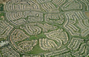
The neighborhood view, like the parcel-to-parcel tool, is also a great marketing tool. It too will open up an entire subdivision or commercial corridor for you to measure to your hearts content. It’s a great tool when you need to measure all of the mulch beds or sidewalks in an HOA, or when you have a big commercial office park with several lots that you need to measure for sealcoating.
In many areas of the U.S. we have two types of neighborhood views for our users to access in our software. Both allow you to view and measure miles and miles of property in one photo.
They Arrow Keys
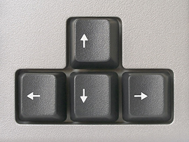
The arrow keys aren’t as widely used or well known as the parcel-to-parcel tool and the neighborhood view. These hidden gems will move your photos around when you have the measuring tools on in Go iLawn and Go iPave.
So if you want to stay as zoomed in as you possibly can when you’re measuring something for an estimate, you can! Simply press the up, down, left and right arrow keys on your keyboard when you have the area tools or linear distance tool in use, and your photo will move around so you can keep on keeping on.
How do you Measure Properties Faster?
Now that we’ve shared some of our tools and insider tips, we’d love to hear from you. What do you do when you use Go iLawn and Go iPave to measure properties faster and better than ever before? Tell us in the comments section of this post.


Leave a Reply
Want to join the discussion?Feel free to contribute!