3 Property Photos That Will Inform Your Team And Impress Your Customers
high-res·o·lu·tion– Relating to an image that has fine detail.
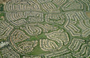 A feature in our property measurement software that consistently “wow’s” our users- and their clients- are the high resolution aerial photos our customers measure properties with.
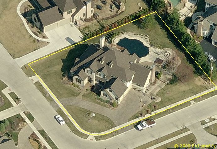
Because our photos are taken from an airplane rather than a satellite, the image resolution is much higher than a satellite photo, providing clearer, unobstructed, leaf-off property photos from multiple directions.
The clarity of the photos not only helps contractors easily measure properties for landscape, pavement maintenance and snow removal estimates, but it also helps them impress their customers during the sales process.
Impress & Inform with High Resolution Property Photos
No matter what type of estimate you’re measuring a property for, saving photos from Go iLawn and Go iPave is a must! It’s an easy thing to do and we recommend saving multiple property photos when measuring. In fact, there are three types of property photos that we would absolutely recommend you save every time you measure a property: a ‘blank slate’ photo, a ‘strategic outline photo’, and a ‘closer and communicator’ photo.
Your ‘Blank Slate’ Photo- No Notes, Labels or Color-Coding
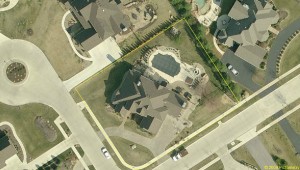
A blank slate photo, or a clear photo of the property with no labels or drawings is a good one to have on hand. This will show you all of the property’s features without interference. Plus if there are future projects for the property, you have a nice clean photo of the property to start with. You can print the photo and make notes on it, or put it into your CAD or design program.
To save your blank slate photo, either save the picture right away before you start measuring, or if you’ve already taken measurements, select the “hide all” option on the measurement results panel, and a nice clear view of the property will be yours.
At the end of the day, this is just super handy to have around, so why not, right?
Your ‘Strategic Outline’ Photo- Notes, Labels & Color Coding for Staff & Crews
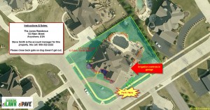
Account manager contact information, turf square footage, irrigation controls and other important property information is found in this photo.
Once you’ve measured the property, color-code and label it for your team so it demonstrates your strategic plan for servicing the property.
Color-code the property’s features for service type, equipment to be used, or any other specifications that may be helpful to your team. For example, some of our clients like to put the total square footage in the property photo for use within departments, but they don’t necessarily want their client to see the numbers.
You can also label street names, irrigation controls, and important property features or instructions your crews might need to know. Contact information for the account manager, may be helpful as well.
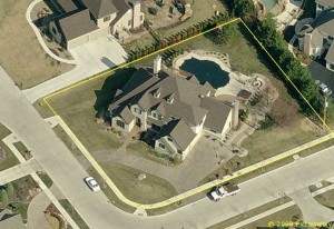
You can use our tools to label your photo with your strategic plan, or a photo program. The picture to the right was labeled with the Go iLawn labeling tools and also in Snagit.
Your ‘Communicator and Closer’ Photo- Notes & Labels for Prospects & Clients
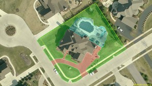
Green is what we will mow. Red is what we will service in snow. Blue is set for shrub maintenance and cleanup around the pool.
Property owners enjoy seeing their home or building from the sky. It’s a fact. Often when we meet people at trade shows, the first thing they want to see on Go iLawn or Go iPave is their own property. For us, it’s a way to demonstrate the reliability of our property measurement software.
For you, these photos can demonstrate to your client that you are prepared and you have a plan for servicing their property. It also helps make your scope of work tangible and clearly demonstrates what you’re proposing to service.The conversation to add, subtract or change services may come easier too.
Take Advantage of our Aerial Photos
Aside from the photos mentioned above, we have several other property photos you can save to help you inform your team and impress your customers and prospects.
Neighborhood photos will show you the property from a higher altitude (offering a great perspective of commercial properties or subdivisions that you care for multiple properties in).
Directional views show you photos of properties from the north, south, east and west, giving you a nice walk-around perspective of the property that you’re measuring. You can even measure the slope of the property in these views as well as height of a building, tree, lamp post etc.
Give these a try the next time you measure a property!
What do you usually include in your Go iLawn or Go iPave photos?





Leave a Reply
Want to join the discussion?Feel free to contribute!