Best Practices: How to Locate Properties in Go iLawn & Go iPave with Latitude and Longitude
This is the first monthly column for our Best Practices Series
Landscape and pavement maintenance contractors can measure any property, anywhere on Go iLawn and Go iPave.
Although winter weather and cold temperatures will still be around for a few more months, landscape and pavement maintenance contractors are already gearing up for their busy season. This means they’ve started measuring properties for spring estimates.
We have 100% coverage of the U.S and Canada, allowing contractors to measure any property, anytime and anywhere they’ve got an internet connection. Yep, that’s right, if there’s a piece of land out there, by golly you can measure it on Go iLawn and Go iPave– even if the property doesn’t have an address.
For example, we have many clients who mow highway medians and maintain remote utility substations, and all they are given to locate the property are the GPS coordinates and maybe some driving directions. Can you imagine the time spent trying to drive out to these remote locations and field measure? Not to mention the safety risks crews are exposed to when field measuring highway medians.
And even some commercial properties, especially when they’re located on a property with multiple addresses or tenants can be difficult to locate.
But don’t worry, any property, even the hard-to-find, can be easily located with a little-known searching method that will get you to where you need to go in a matter of seconds. How is this possible, you ask?
Important Information Underneath Go iLawn and Go iPave Photos
Several layers of information including a map, scale, parcel information, and latitude and longitude coordinates (among other things) sit underneath the images on Go iLawn and Go iPave. This allows our users to search for properties in a variety of ways:
- Using a property address
- Using a business name
- Using a street intersection
- Using latitude and longitude coordinates
Locating a property with any of these criteria requires the user to know the information they want to search with, so using latitude and longitude probably falls at the bottom of the list as far as easily accessible information goes.
Not anymore. It turns out that it’s really easy to get latitude and longitude from a free mapping site, and it’s even easier to plug the coordinates into Go iLawn and Go iPave in order to measure properties.
Find the Hard to Find in a Few Steps
Let’s use an address for a commercial property in multi-tenant building as an example: 7157 E Kemper Rd, Cincinnati, OH, 45249. This is a good example because it seems like it should be searchable, but it often throws off mapping programs (ours included).
First we will try it in Go iLawn
Go iLawn couldn’t locate this property based on the address information I typed in. When this happens, our program will give you one of two responses. One response will simply say “No Results Found”. This would require you to search again with new information.
The second response will tell you we couldn’t find an exact match and will offer two options: a list of suggested addresses (usually you can find the address or a nearby address in this list to get you to where you want to go), and a Bing approximate locater. The Bing approximate locater will take you where Bing maps takes you, so you can always try the address in Bing before choosing that option.
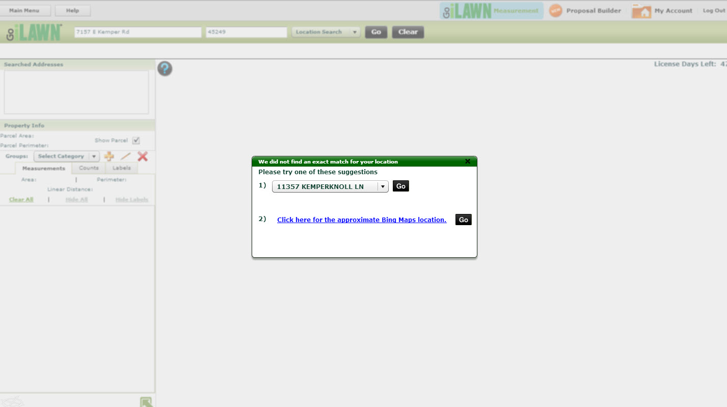
If we can’t locate your property, you will likely see this response. Click on the photo to enlarge.
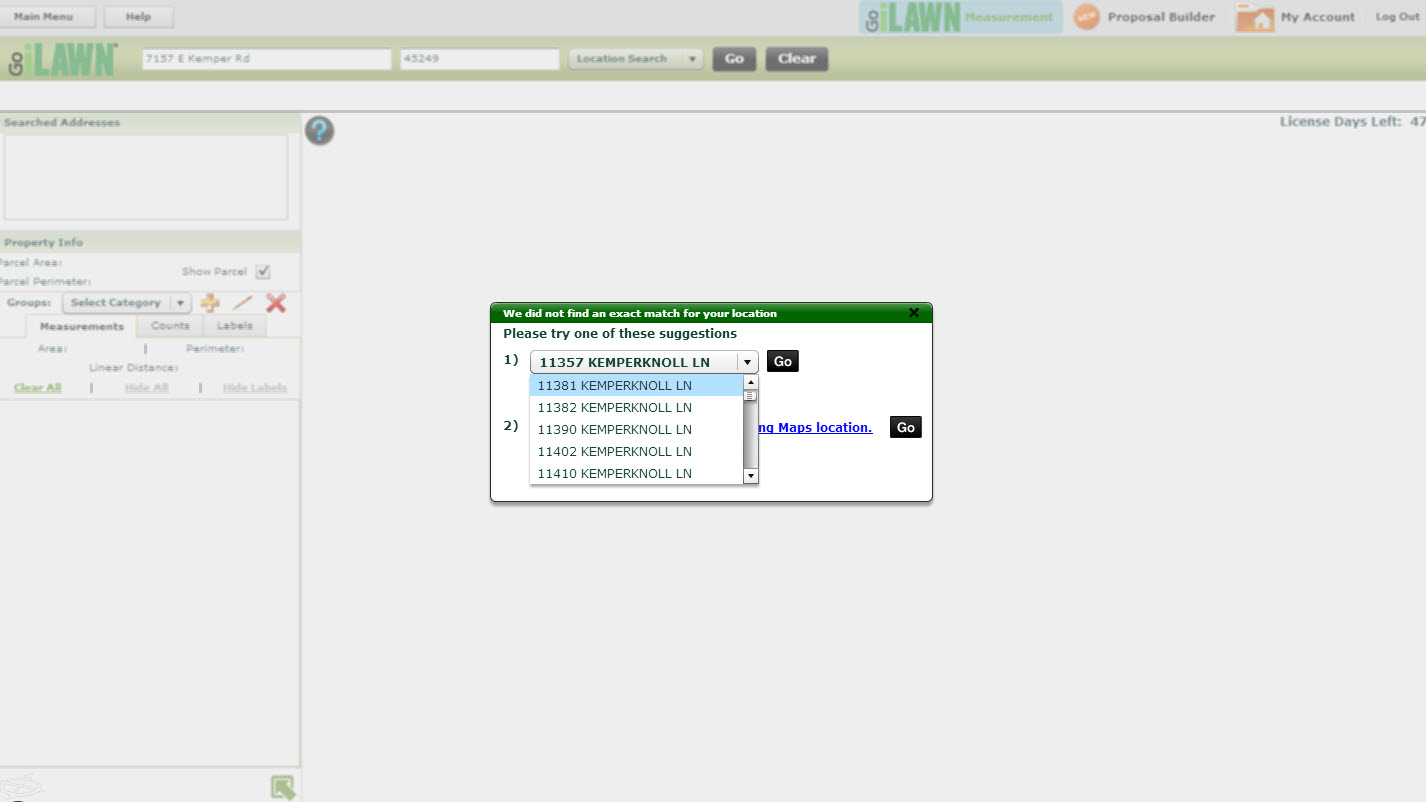
The first option contains a list of suggested addresses that will usually show you the results you need. Click to enlarge.
If you cannot find the address you are looking for in our list of suggestions, and you don’t want to choose the Bing approximate locater, close out the suggestion box and try searching with latitude and longitude.
Pull Latitude and Longitude from Google Maps
Start by going to a mapping website. We’ll use Google Maps in our example since it’s widely used and easy to navigate. Now we’ll try the address in Google. Google drops me out in an intersection near the property I want to measure.
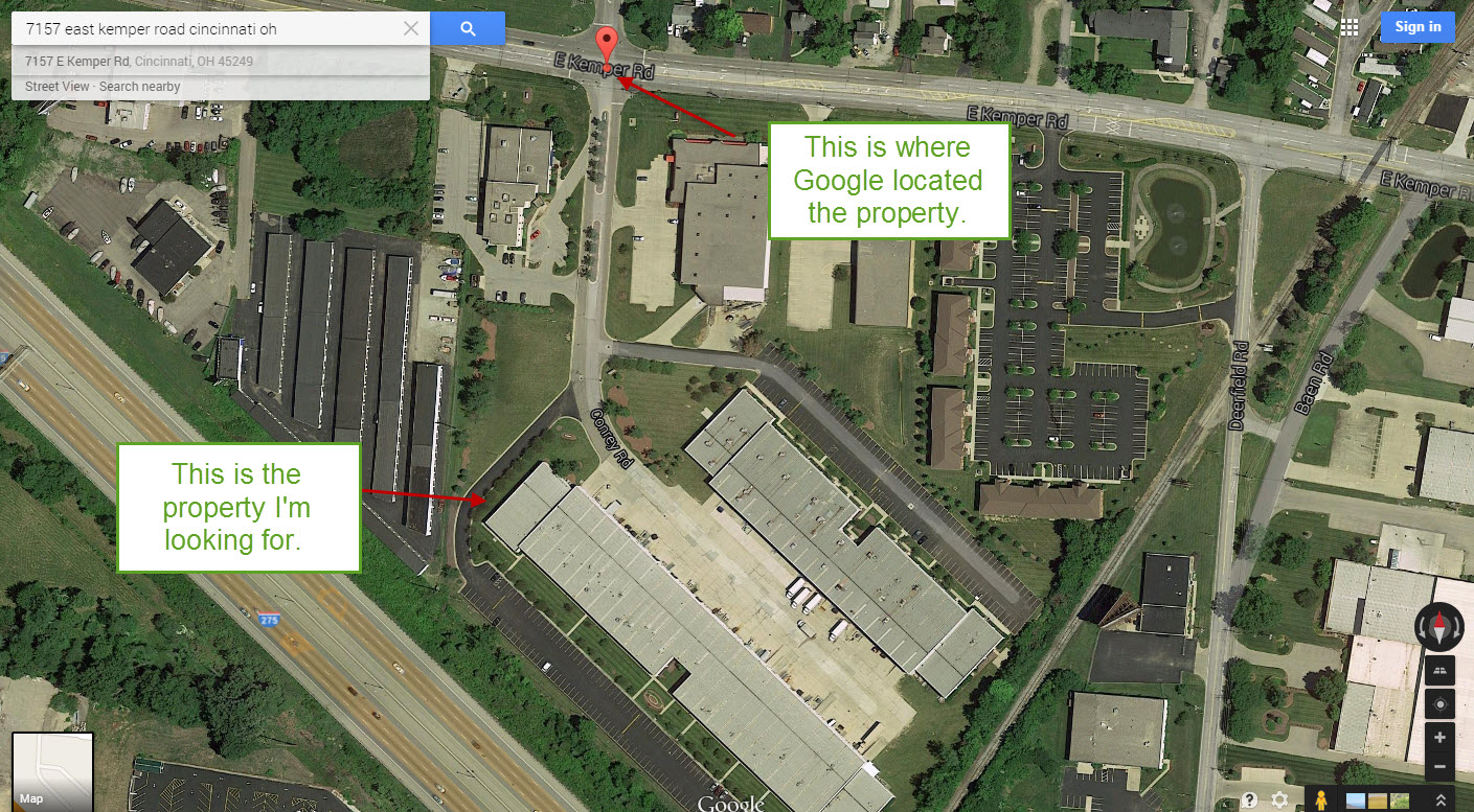
Google maps results for 7157 E Kemper Road, Cincinnati, OH. Click to enlarge.
As in the example above, you may need to navigate around the map where Google first places you to find what you are looking for, but once you have your eyes on the property, right click on the rooftop (or any feature on the property) and a menu with options will drop down. Select the “What’s Here” option from the menu.
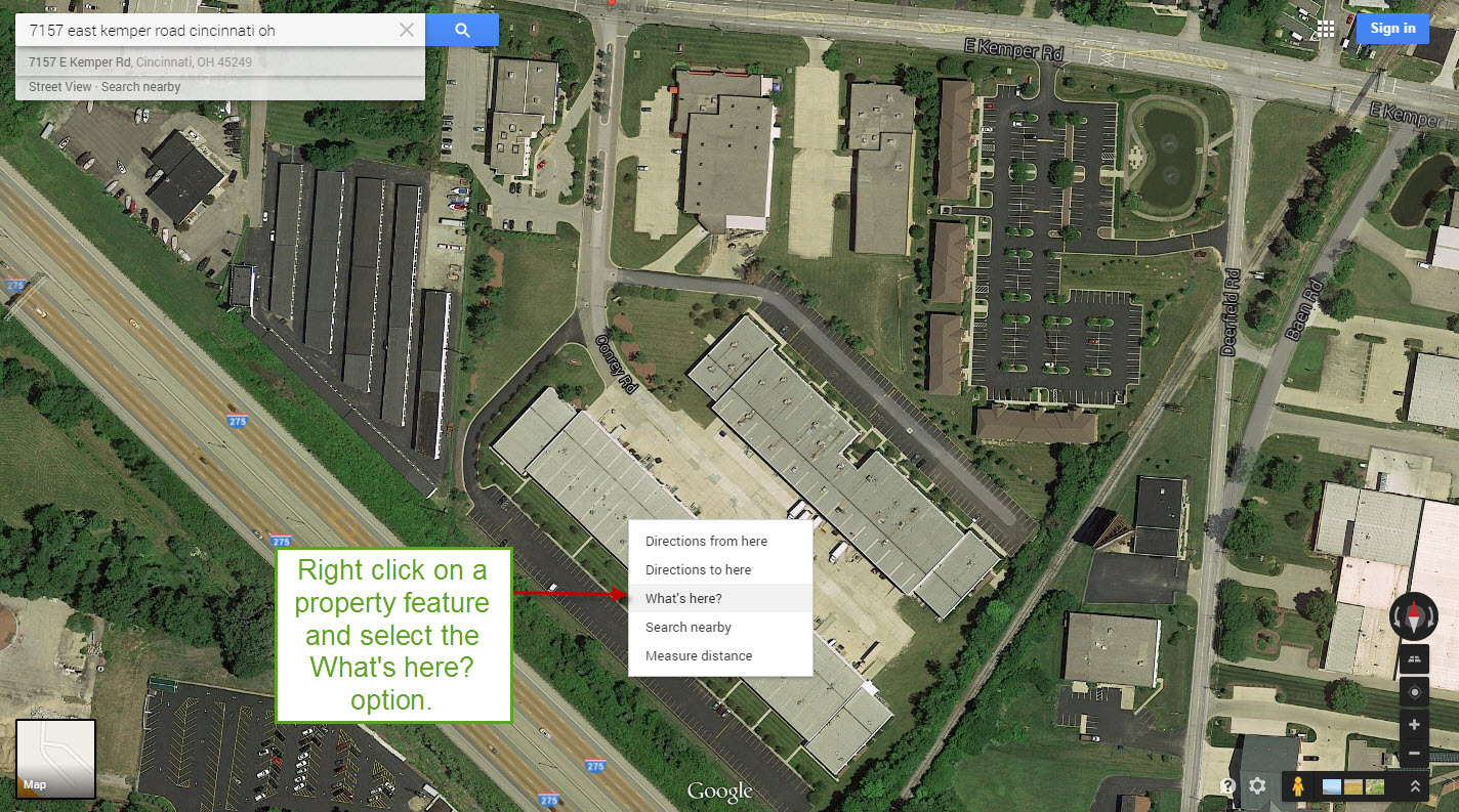
Once you locate your property in Google, right click on the property and select What’s here? from the menu. Click to enlarge.
Once you select “What’s here?”, your latitude and longitude coordinates will appear in the upper right corner of the screen. Highlight them and hit CTRL and C on your keyboard to copy the coordinates.
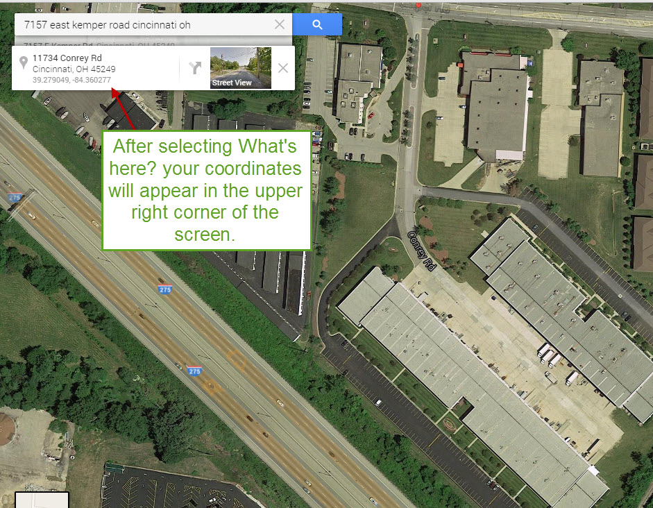
Your latitude and longitude will appear in the upper right corner of the screen where you can copy them. Click to enlarge.
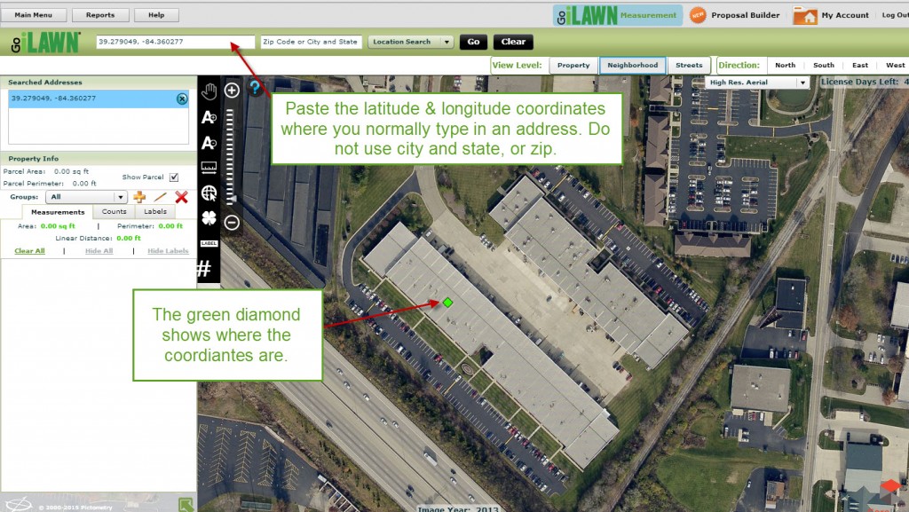
Go to back to the Go iLawn or Go iPave measuring screen and paste the coordinates in where you normally type in an address, business name or street intersection. Hit “Go”, and our program will place you right on the coordinates and show you the image of the property you are looking for.
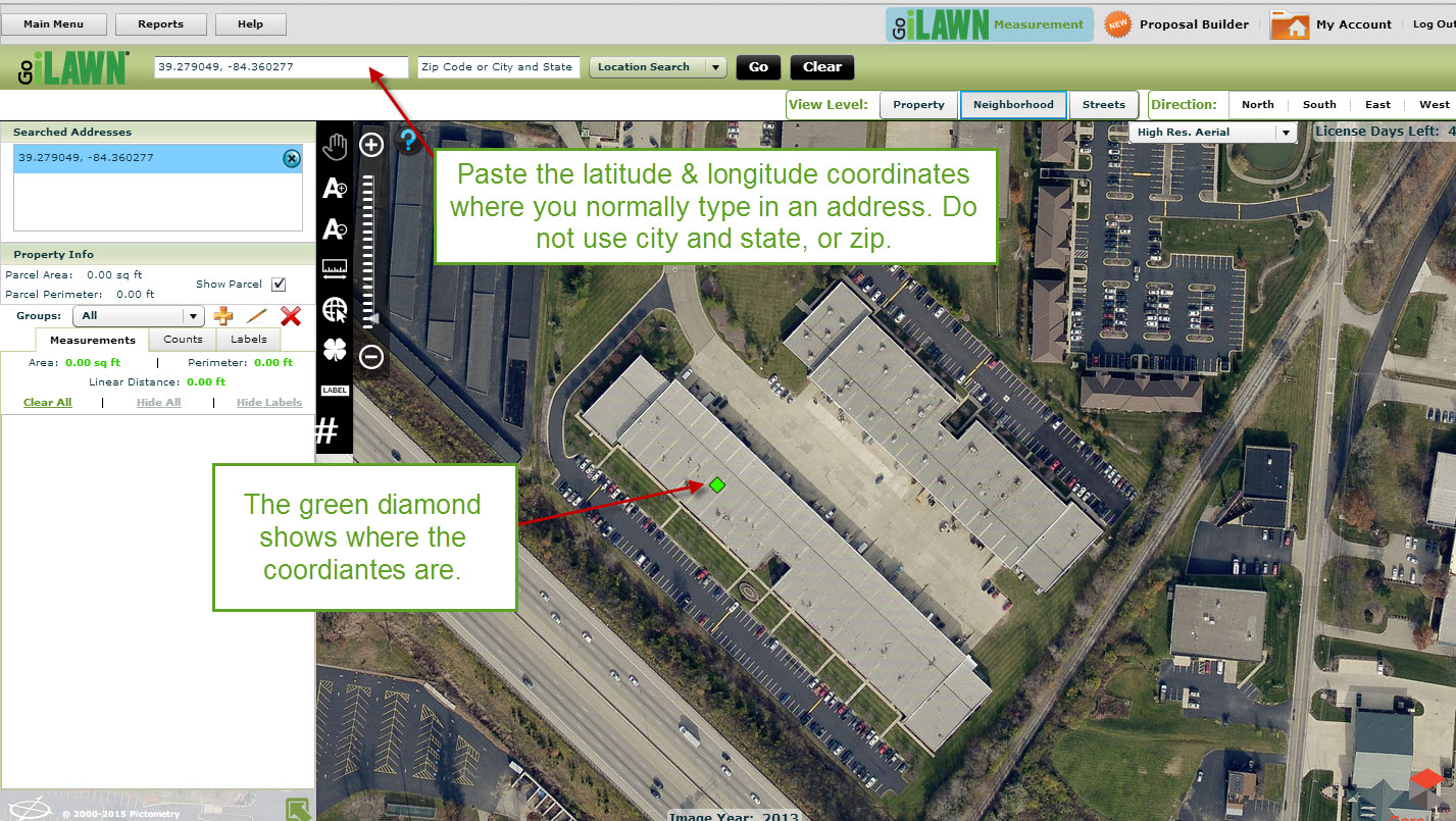
Using the latitude and longitude to locate properties is very accurate. Click to enlarge.
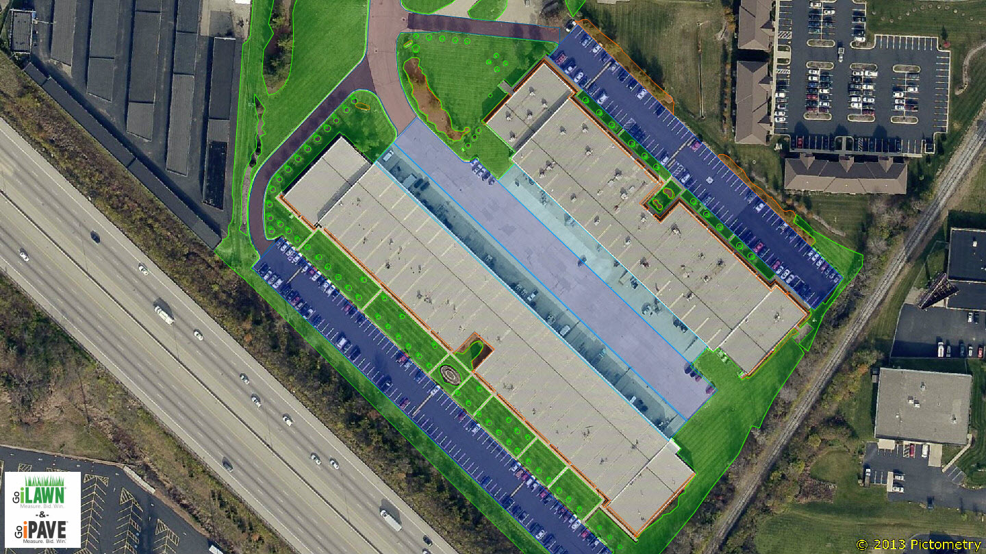
Now you can measure away!
After locating this property with latitude and longitude coordinates, I was able to measure 397,351 sf of turf, mulch, asphalt, sidewalks and more.


Leave a Reply
Want to join the discussion?Feel free to contribute!